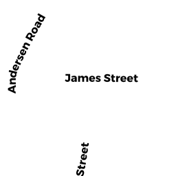
989 JAMES ST
Owner Information
CHICOPEE CHILD DEVELOPMENT
989 JAMES ST
CHICOPEE, MA 01022 1034


Property Details
989 JAMES ST is classified as a Local Use Code Variation for tracking and administrative purposes, Same as "9430". (Church/temple).
The primary structure on this property was built in 1960. There are 11,650ft2 of built area within this property. There is 10,970ft2 of residential/living space within this property.
989 JAMES ST is valued at $828,800. The land is valued at $168,700 and the structures are valued at $648,100. There is an additional valuation of $12,000 on this property.
This property is in Zone 0. Confirm with local Zoning Board authorities to ensure there are no overlays or other easements on this property.
The most recent deed for 989 JAMES ST is recorded at the local registrar in Book 4967, Page 1. 989 JAMES ST was last sold on Wednesday, July 16, 1980 for $0.
Assessment data from fiscal year 2022.
Flood Data
According to the FEMA National Flood Hazard Layer, this property does not appear to be in a flood zone. It may also be in an area not yet reviewed. Nonetheless, confirm this information prior to taking any action.
To view the flood hazards around this property, create a FEMA "Firmette" Map of the area around 989 JAMES ST.
Broadband Internet Providers
| Provider | Type | Bandwidth (mbps) | |
|---|---|---|---|
| Viasat Inc | Satellite | 100 | 3 |
| HughesNet | Satellite | 25 | 3 |
| GCI Communication Corp. | Satellite | 0 | 0 |
| Charter Communications Inc | Cable | 940 | 35 |
| Verizon New England Inc. | DSL | 10 | 1 |
| VSAT Systems, LLC. | Satellite | 2 | 1 |
Broadband service provider data from December 2020.
Adjacent Properties
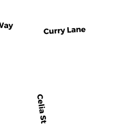
- 48 RICHMOND WAY
Residential Condominium owned by REED GEORGE A & - 52 RICHMOND WAY
Residential Condominium owned by HUBBARD CAROLE - 55 RICHMOND WAY
Residential Condominium owned by ROSE STACEY LEIGH - 51 RICHMOND WAY
Residential Condominium owned by RECOR PATRICK R - 47 RICHMOND WAY
Residential Condominium owned by RICKSON ROBERT F & - 43 RICHMOND WAY
Residential Condominium owned by MCDONNELL MICHAEL P SR & - 37 RICHMOND WAY
Residential Condominium owned by MULLIGAN KAREN A & - 31 RICHMOND WAY
Residential Condominium owned by WINSLOW REYNOLDS B - 25 RICHMOND WAY
Residential Condominium owned by RODZWELL BETTE ANN - 19 RICHMOND WAY
Residential Condominium owned by BOGDANOVICH FRANK & - 62 RICHMOND WAY
Residential Condominium owned by PAQUETTE RAYMOND E JR & - 70 RICHMOND WAY
Residential Condominium owned by SOILLIS JACQUELINE R - 78 RICHMOND WAY
Residential Condominium owned by SIEPIERSKI GAIL M - 81 RICHMOND WAY
Residential Condominium owned by MCDONNELL DANIEL F & - 71 RICHMOND WAY
Residential Condominium owned by PATENAUDE ROBERT P - 67 RICHMOND WAY
Residential Condominium owned by CHARTER JANICE M - 0 RICHMOND WAY
Other, Open Space owned by CONDO MAIN - 35 CURRY LN
Residential Condominium owned by CROSS JENNIFER & CHRISTOPHER - 54 RICHMOND WAY
Residential Condominium owned by DESANTY WILLIAM J - 75 RICHMOND WAY
Residential Condominium owned by MORRISON HARVEY; JACQUELINE - 12 RICHMOND WAY
Residential Condominium owned by DAVIDSON CLARKE YVETTTE - 16 RICHMOND WAY
Residential Condominium owned by LAROCHE KEITH N & - 24 RICHMOND WAY
Residential Condominium owned by LAMOUREUX THERESE L - 28 RICHMOND WAY
Residential Condominium owned by DAUBNEY PATRICIA E - 32 RICHMOND WAY
Residential Condominium owned by GIROUX JOSEPH W & - 38 RICHMOND WAY
Residential Condominium owned by HECKMAN BELINDA M - 44 RICHMOND WAY
Residential Condominium owned by PAULO BARBARA D - 1 CURRY LN
Residential Condominium owned by ODONNELL KATHLEEN TRUSTEE - 7 CURRY LN
Residential Condominium owned by GAGNON JAMES R & DEBORAH - 13 CURRY LN
Residential Condominium owned by GAZAILLE KLARA M - 17 CURRY LN
Residential Condominium owned by MARTIN MICHAEL F & - 27 CURRY LN
Residential Condominium owned by GILMORE GLORIA J - 33 CURRY LN
Residential Condominium owned by ORSZULAK LORIE A - 30 CURRY LN
Residential Condominium owned by MILLETT JEANNINE & - 26 CURRY LN
Residential Condominium owned by TRIPLE JCD LLC - 22 CURRY LN
Residential Condominium owned by DAUBNEY JEANNINE P - 18 CURRY LN
Residential Condominium owned by STANISLAS ALAIN H - 14 CURRY LN
Residential Condominium owned by CRAWFORD BURNARD & - 8 CURRY LN
Residential Condominium owned by AINSWORTH CHARLES E III - 20 RICHMOND WAY
Residential Condominium owned by GOULET DAVID H & BETTE J